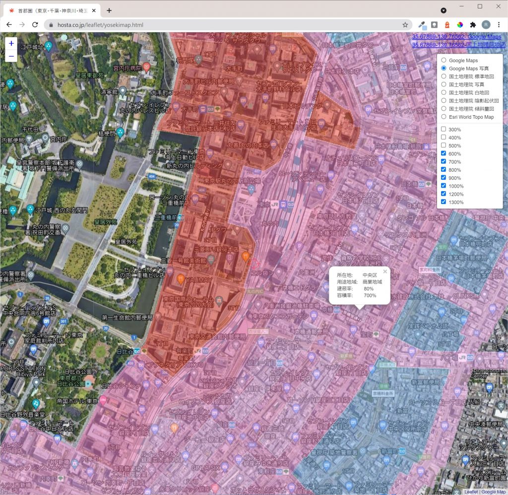
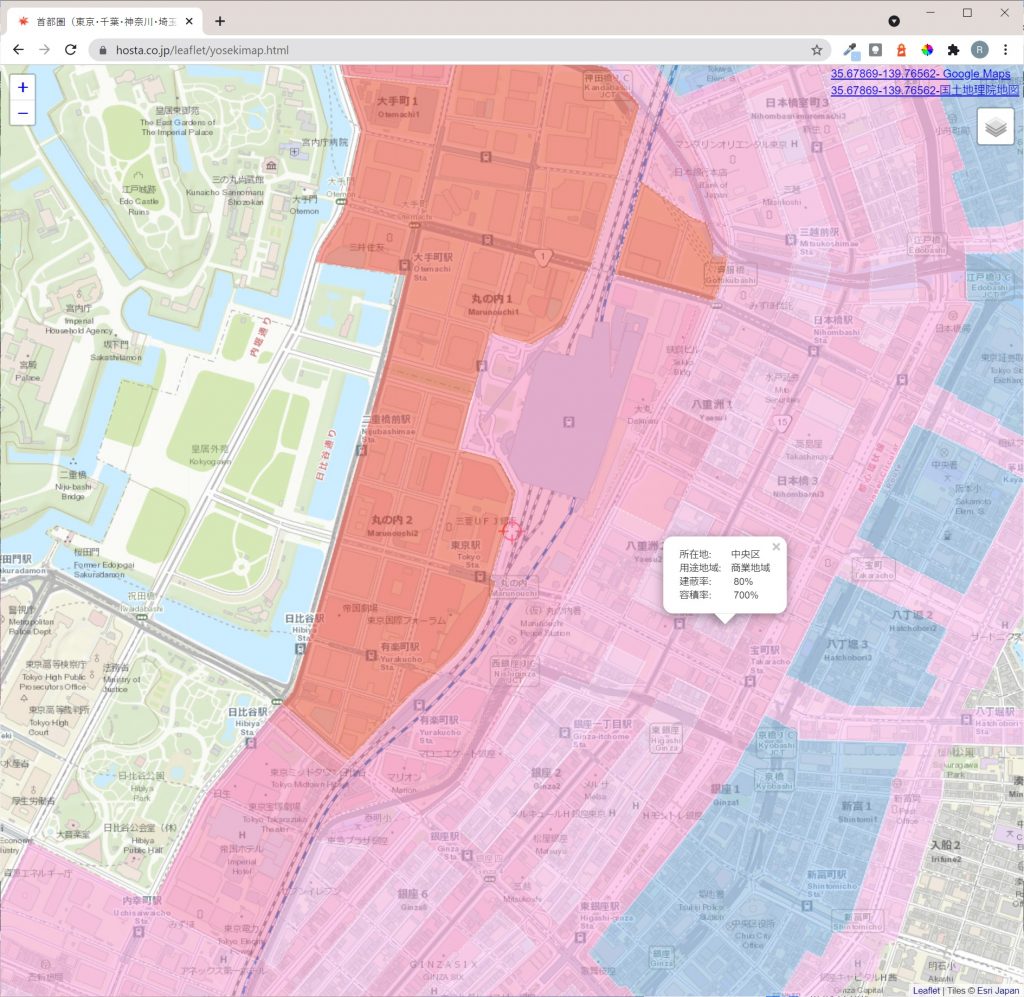
土地利用状況・都市計画情報の確認に有用なMapToolを公開しています。
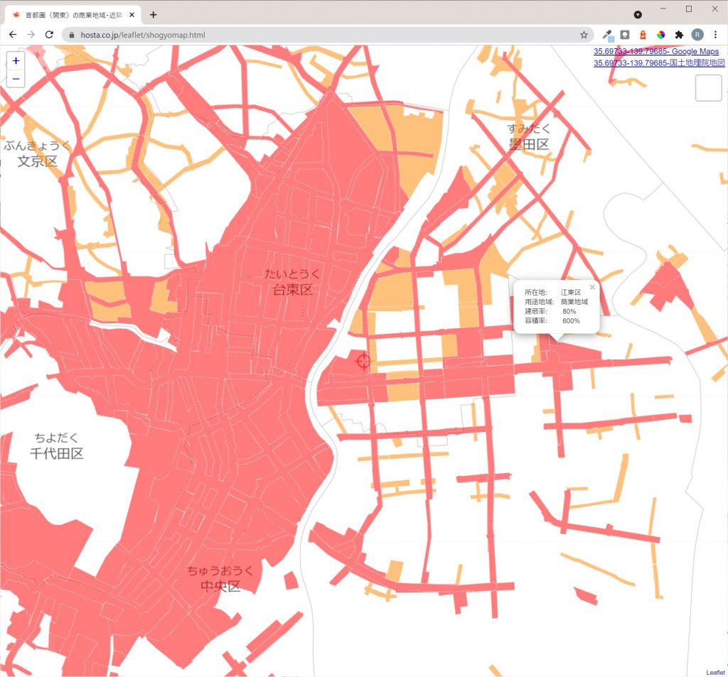
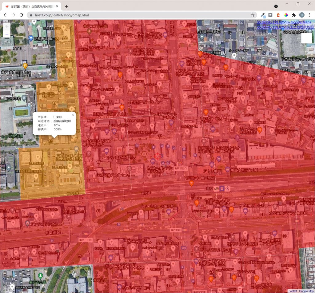
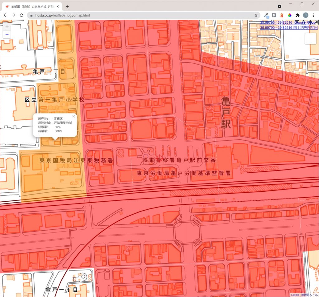
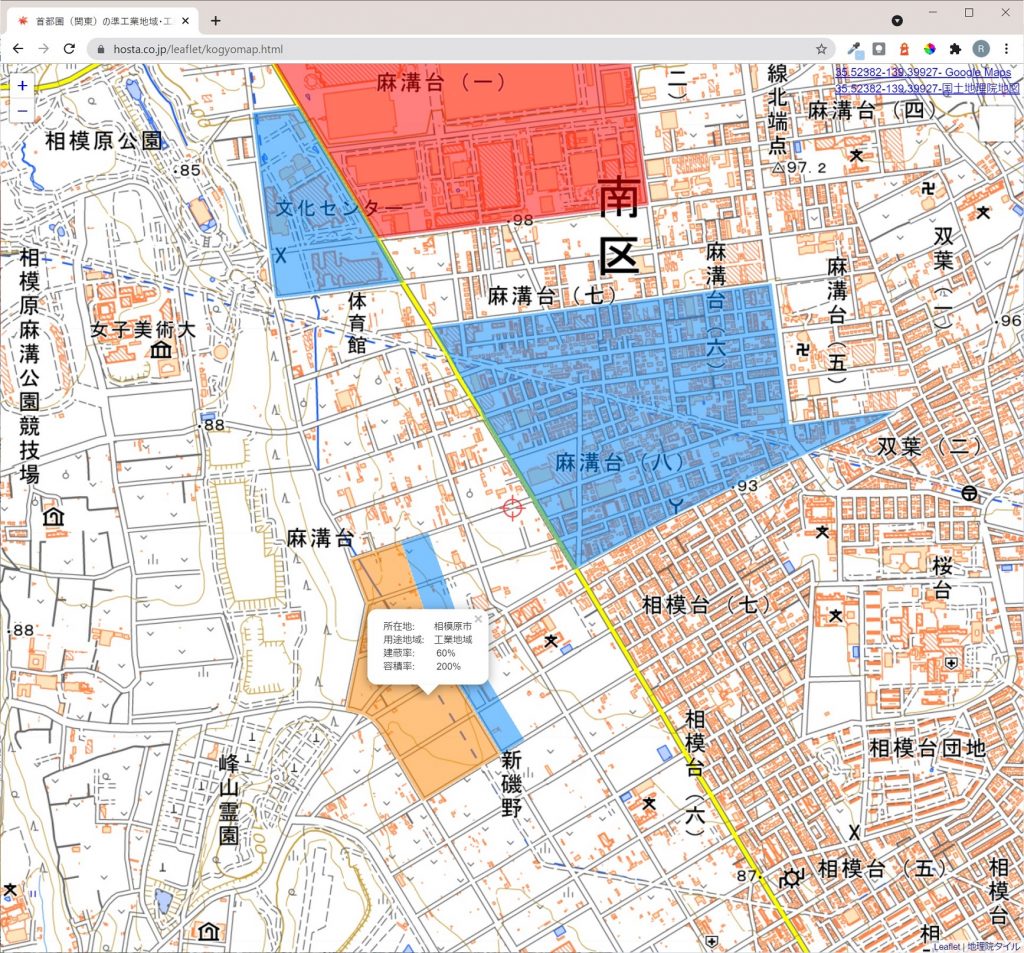
都市計画情報をマッピングした地図を国土地理院地図・GoogleMaps・空中写真などに切り替え可能です。
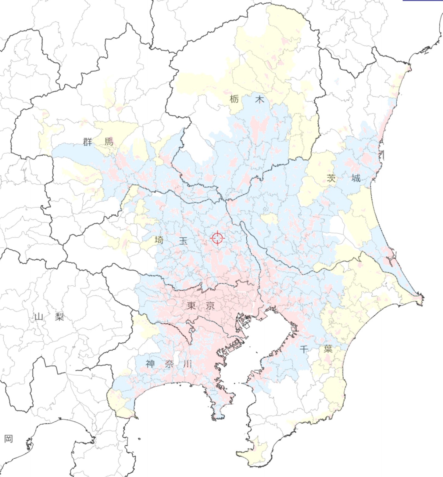
都市計画区域の市街化区域・市街化調整区域・区域区分が定められていない都市計画区域(非線引き)の表示をしています。
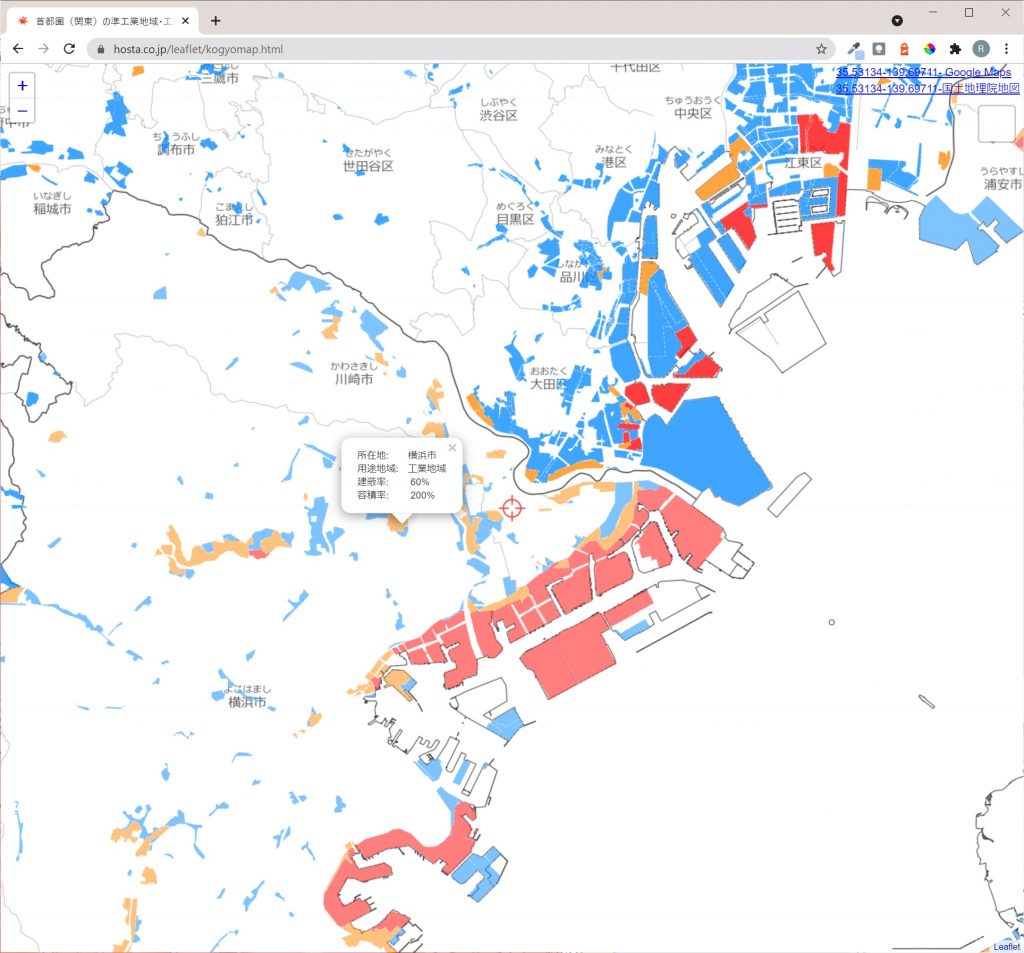
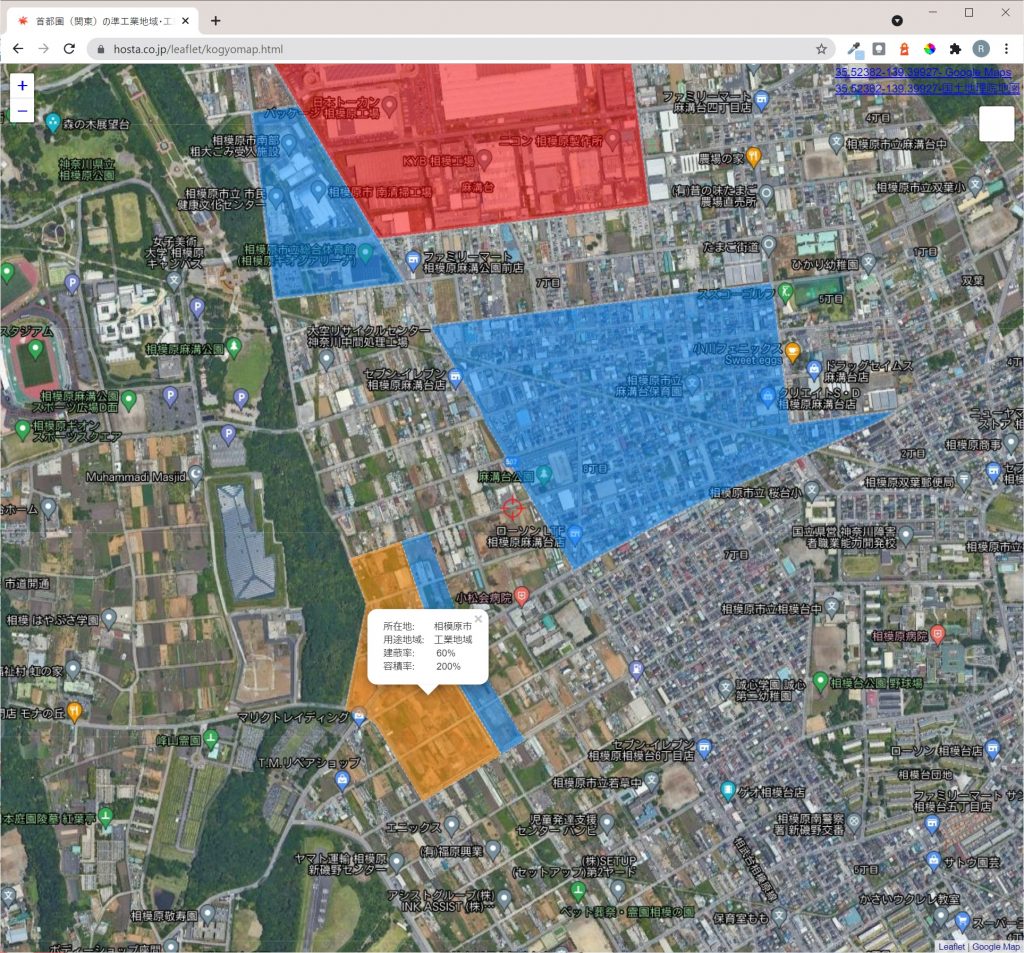
また用途地域のうち、商業地域・近隣商業地域、準工業地域・工業地域・工業専用地域およびそれらの建蔽率・容積率の表示をしています。
データ量がありますので、通信量・通信速度の心配のない環境でご利用ください。
各種地図を無償または有償にて製作致しますので、お気軽にご用命ください。
首都圏(関東)の都市計画区域のMap Tool
![都市計画情報地図](https://i2.wp.com/realestate.hosta.co.jp/wp-content/uploads/sites/3/2021/07/2adcfff433a432794f6164cf093588dc.jpg?ssl=1&resize=1793%2C1793)
![](https://i1.wp.com/realestate.hosta.co.jp/wp-content/uploads/sites/3/2021/07/b98066391aea9d34459beada63abcdd1.jpg?ssl=1&resize=1793%2C1793)
![](https://i0.wp.com/realestate.hosta.co.jp/wp-content/uploads/sites/3/2021/07/385809e49f2e97b9c8b47972a45c41dc.jpg?ssl=1&resize=1793%2C1793)
![](https://i0.wp.com/realestate.hosta.co.jp/wp-content/uploads/sites/3/2021/07/44d4335824f82c8f5021a43a9aa28769.jpg?ssl=1&resize=1793%2C1793)
![](https://i2.wp.com/realestate.hosta.co.jp/wp-content/uploads/sites/3/2021/07/49a3af0d230dc0f255dd9b014970e3c4.jpg?ssl=1&resize=1793%2C1793)
![](https://i1.wp.com/realestate.hosta.co.jp/wp-content/uploads/sites/3/2021/07/159c94f4b37e1a0e205388a41209deb4.jpg?ssl=1&resize=1793%2C1793)
![](https://i2.wp.com/realestate.hosta.co.jp/wp-content/uploads/sites/3/2021/07/6ef15eea35f39ca680d8786a720ef405.jpg?ssl=1&resize=1793%2C1793)
![](https://i2.wp.com/realestate.hosta.co.jp/wp-content/uploads/sites/3/2021/07/ac98eed4b5645e4616926e47358f97df.jpg?ssl=1&resize=1793%2C1793)
首都圏(関東)の商業地域・近隣商業地域のMap Tool
![](https://realestate.hosta.co.jp/wp-content/uploads/sites/3/2021/07/c9895f64cad4a7d195302a3c2472588c-1024x953.jpg)
![](https://realestate.hosta.co.jp/wp-content/uploads/sites/3/2021/07/0d73d97ed7012212d226dce6531fdf0a-1-1024x953.jpg)
![](https://realestate.hosta.co.jp/wp-content/uploads/sites/3/2021/07/1d0b4ec77b028f57c28a7d26beeb1c4b-1024x953.jpg)
首都圏(関東)の準工業地域・工業地域・工業専用地域のMap Tool
![](https://realestate.hosta.co.jp/wp-content/uploads/sites/3/2021/07/fa941f7edce95902de8320aeb6f8fe73-1024x953.jpg)
![](https://realestate.hosta.co.jp/wp-content/uploads/sites/3/2021/07/a6b730281474ba6a6646b74036636221-1024x953.jpg)
![](https://realestate.hosta.co.jp/wp-content/uploads/sites/3/2021/07/e7069708ae7438ba0fdef86cad2d70c6-1024x953.jpg)
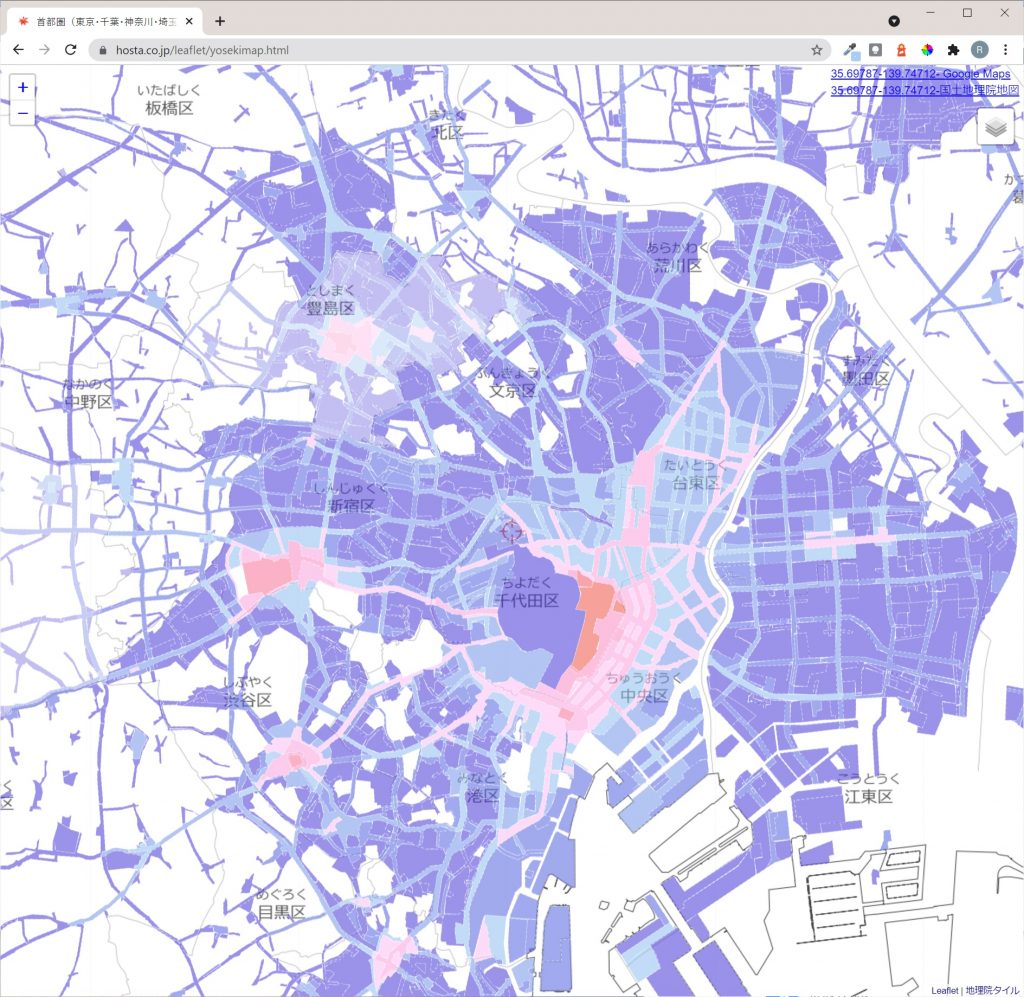
首都圏(東京・千葉・神奈川・埼玉)の容積率分布(市街化区域300%以上) Map Tool
![](https://realestate.hosta.co.jp/wp-content/uploads/sites/3/2021/08/70db4648e6bc5e6331b8c6930d1e4af9-1024x997.jpg)
![](https://realestate.hosta.co.jp/wp-content/uploads/sites/3/2021/08/fb1d5c11c1a6f372d8d85f0673aba695-1024x997.jpg)
![](https://realestate.hosta.co.jp/wp-content/uploads/sites/3/2021/08/b369a17681b525823d09ad94c211e775-1024x997.jpg)
註記
・オープンソースJavaScript libraryのleafletを用いています。
・地図タイルは、国土地理院・Google Maps・esri World Topographic Mapを用いています。
・都市計画データは、国土交通省の国土数値情報geojsonを用いています。https://nlftp.mlit.go.jp/index.html
・都市計画区域情報は、平成30年(2018年)のデータを用いています。
・用途地域情報は、令和元年(2019年)のデータを用いています。
・海老名市のデータは提供されていないため、反映されていません。
・用途地域情報の東京都で所在地nullとなっているものは誤りの箇所があるのを確認しています。
・その他、都市計画に変更がある可能性がありますので、正確な都市計画情報は各自治体にお問合せください。
・以下のブラウザで動作確認をしています。Google Chrome: 91.0.4472.164 Microsoft Edge: 92.0.902.55